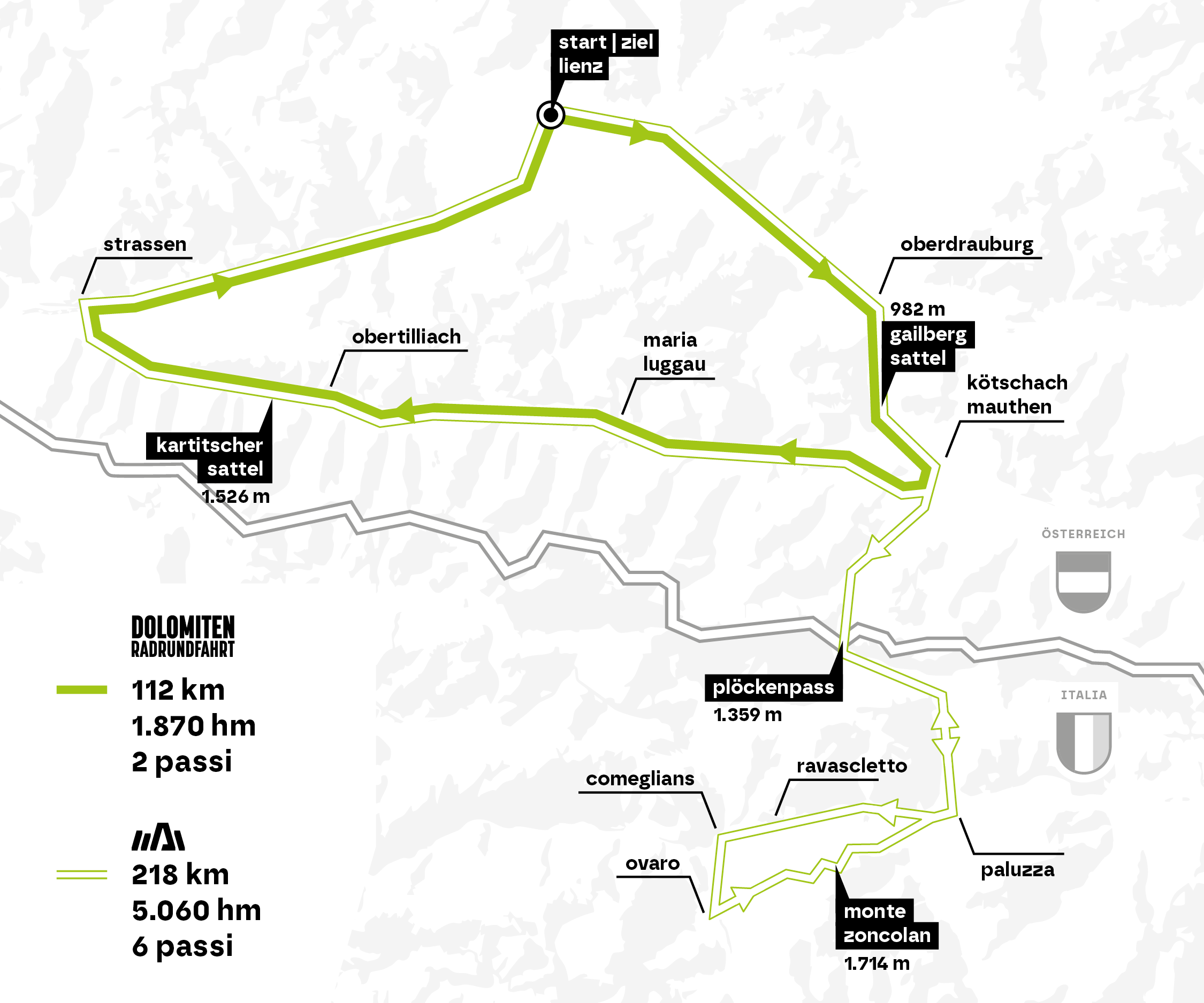
The route also leads onto Italian soil and culminates at Monte Zoncolan, which has often been chosen as the stage finish of the "Giro d`Italia". A total of 5060 metres in altitude and 218 kilometres have to be mastered on the extreme version.
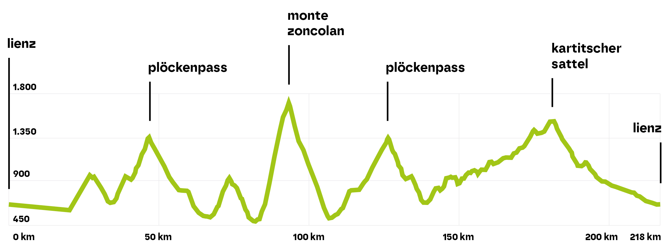
Elevation profile SuperGiroDolomiti
View the route on the interactive map Osttirol
The interactive map Osttirol also shows the course and the altitude profile of the SuperGiroDolomiti. GPX data and a share and print function are also available.